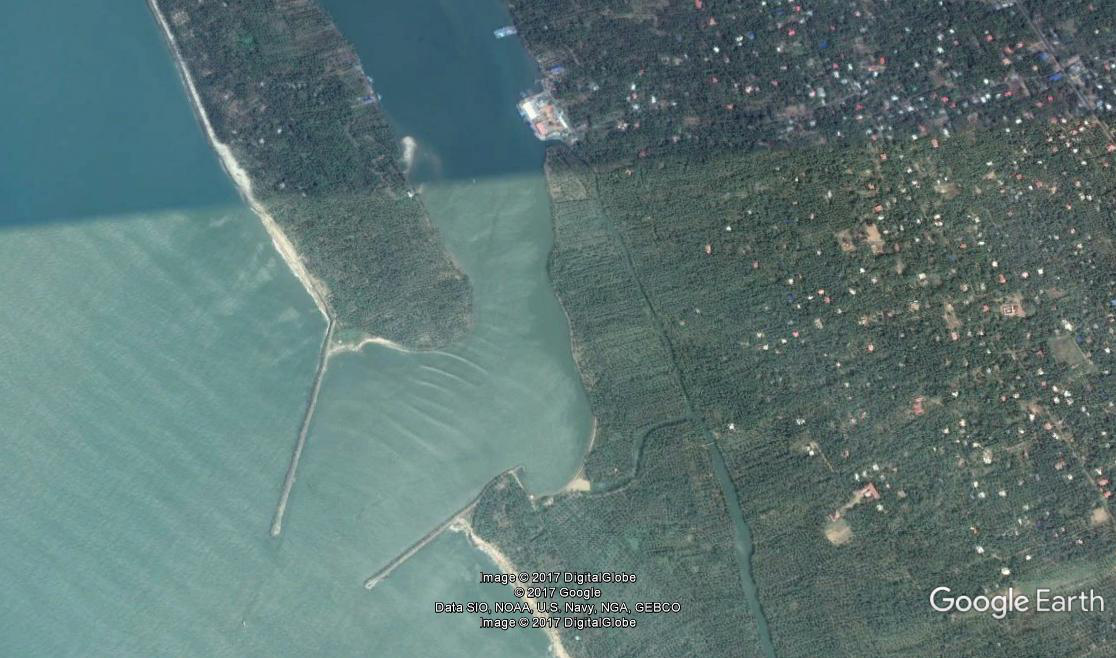
Chettuva Fishery Harbour


|
|
|
|
Type of Harbour |
Esturine |
|
Location |
Latitude: 100 30' N |
|
Longitude: 550 20' E |
|
|
Nearst Town |
THRISSUR |
|
Road Access |
GURUVAYOOR KODUNGALLOR NH 17 |
|
Fishing villages |
Kadappuram, Eangadiyoor, Nattika, Blangad, Vadanappilly, Thalikulam,mandalamkunnu,chendrappinni ,kaippamangalam,perijanam,koolimuttam,manathala |
|
Sanctioned date and amount |
7/4/2010 - 3024Lakhs |
|
Salient Features |
|
|
Design fleet size |
259 mechanised boat,456motorised boat,306nonmotorised |
|
Area of the harbour basin |
120 x 20 |
|
Length of breakwater (1) |
Soth Break water 394 m |
|
Length of breakwater (2) |
North Break Water 492 m |
|
Land area available |
1.1604hector |
|
quay length (m) |
120m |
|
Auction hall (m2) |
1202m2 |
|
Parking area in m2 |
3700m2 (1700m2 concrete surface and 2000m2 GrII metalling done proposal submitted for concreting. |
|
Internal road in m. |
50 m |
|
Other facilities available |
nil. |

 Office of the Chief Engineer
 +91-0471-2459365
  +91-0471-2459365
 ce.hed@kerala.gov.in