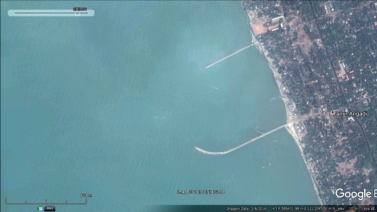
Thanur Fishery Harbour


|
|
|
|
Type of Harbour |
Artificial Basin |
|
Location
|
Latitude : 10.970N |
|
Longitude : 75.870E |
|
|
Nearest Town |
Tanur |
|
Road Access |
Yes |
|
Fishing Villages |
23 Nos. |
|
Sanctioned date and amount |
GO(Rt)No.63/2013/F&PD dt, 30/1/13, Rs. 4487 L No.33013-4/2011-Fy(H) dtd.20.11.2012 |
|
Salient Features |
|
|
Area of the harbour basin |
417000.00 m2 |
|
Length of breakwater (1) North |
740 m – (690 m completed) |
|
Length of breakwater (2) South |
1350 m – (1100 m completed) |
|
Land area available |
Reclaimed Land – 30000 m2 |
|
Quay length (m) |
120 m |
|
Auction hall (m2) |
900 m2 |
|
Parking area in m2 |
25000 m2 |
|
Internal road in m |
1750 m approximate |
|
Other facilities available |
Gear Shed, Net mending shed, Canteen and shop mbuilding , Rest shed, Work shop, Compound wall, toilet block , Water supply and distribution. |

 Office of the Chief Engineer
 +91-0471-2459365
  +91-0471-2459365
 ce.hed@kerala.gov.in