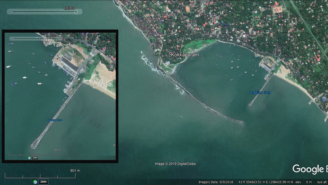
Thalai Fishery Harbour


|
|
|||
| Type of Harbour | Esturine / Artificial Basin | ||
| Location | Latitude: 11⁰ 43’ N. | ||
| Longitude: 75⁰ 30’E. | |||
| Nearst Town | Thalassery | ||
| Road Access | Direct Access from NH66 | ||
| Fishing villages | Muzhappilangad, Thuruthi, Dharmadom, Palisseri, Thalassery City, Gopalapetta, Thalai, NewMahe, Kurichiyil | ||
| Sanctioned date and amount | GO (Ms) No. 16/07/F&PD Dated, 13/04/2007 Rs.1925.74 L | ||
| Annual production (approximate) | 50 tonnes (Present) | ||
| Project Cost final | Not completed. | ||
| Major additions | Nil | ||
| Completed date | Under progress | ||
| Present Status | 85% work completed | ||
| Salient Features | |||
| Design fleet size | 9.10m to 12.00m size MFVs | ||
| Area of the harbour basin | 32.50 Hectare | ||
| Depth at the entrance channel | -3.00m CD (proposed) | ||
| Depth in the proposed harbour basin | -2.50m CD (proposed) | ||
| Length of breakwater (1) | 815m (Main) | ||
| Length of breakwater (2) | 450m (Leeward) | ||
| Land area available | 1.70 Hectares | ||
| quay length(m) | 113m | ||
| Auction hall (m2) | 332m2 | ||
| Parking area in m2 | Parking area:1472m2, Loading area: 664m2 | ||
| Internal road in m. | 386m | ||
| Other facilities available | Administrative Building, Canteeen & Provision store, Gear shed, Work shop building, Net mending hall, Toilet block, OH tank & Open, Well Water supply, Drainage system etc. | ||

 Office of the Chief Engineer
 +91-0471-2459365
  +91-0471-2459365
 ce.hed@kerala.gov.in