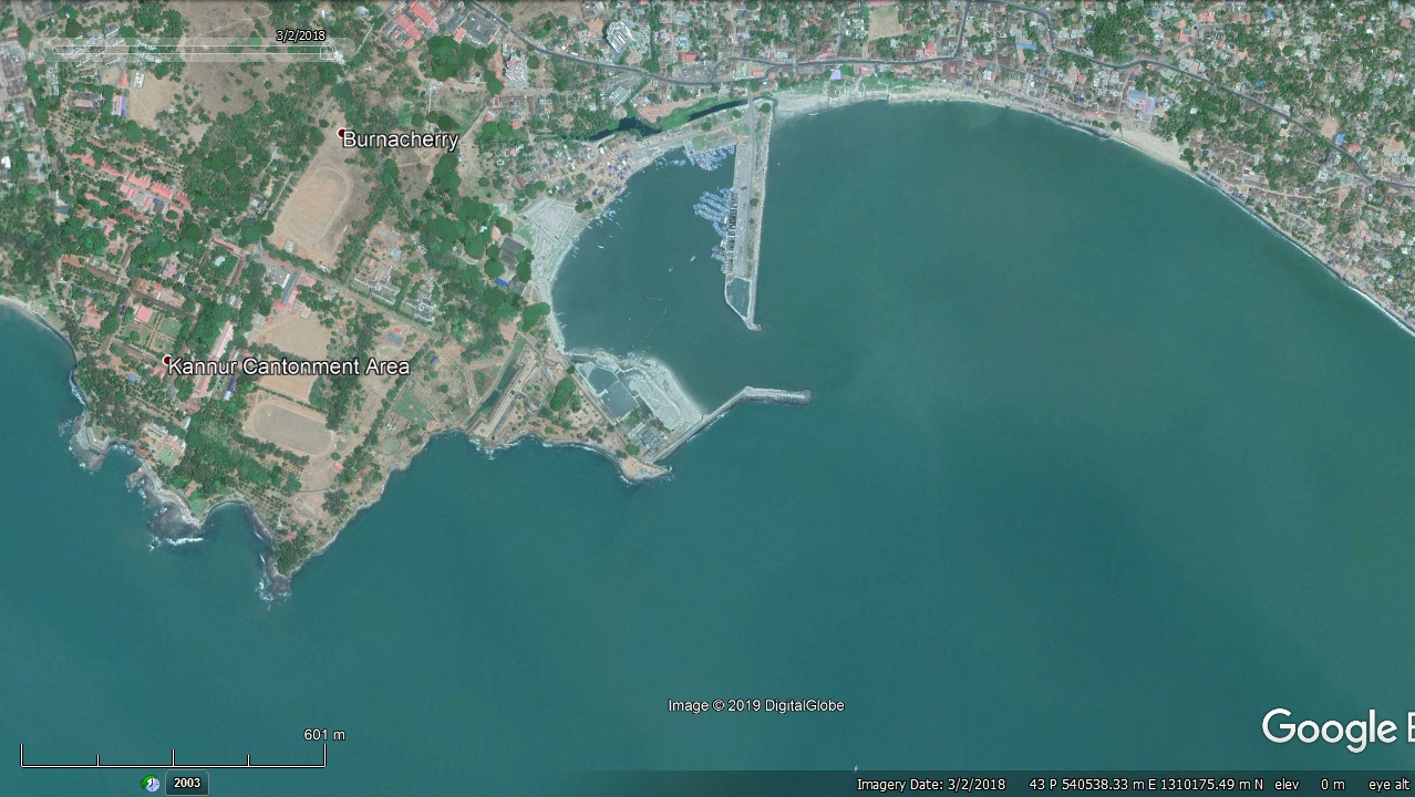
Moplabay Fishery Harbour


|
|
|||
| Type of Harbour | Artificial Basin | ||
| Location | Latitude: 110 51’ North | ||
| Longitude: 750 22’ East | |||
| Nearst Town | Kannur | ||
| Road Access | 1.5 Km away from NH-66, 6M wide PWD road available to reach NH-66 | ||
| Fishing villages | Thayyil, Edakkad | ||
| Sanctioned date and amount | Vide A.S.No.33013-10/91-FY(H) date 18-03-1998 Rs.816 L | ||
| Annual production (approximate) | 30 tonnes | ||
| Project Cost final | Rs.1071 Lakhs | ||
| Major additions | Nil | ||
| Completed date | May 1999 | ||
| Present Status | 100% | ||
| Salient Features | |||
| Area of the harbour basin | 13.49 Hectors | ||
| Length of breakwater (1) | 360 m (Main break water) | ||
| Length of breakwater (2) | 471 m (Leeward Break water) | ||
| Land area available | 5 Acre 67 cent | ||
| quay length(m) | 170 m | ||
| Auction hall (m2) | 164 m x 15 m = 2460 m2 | ||
| Parking area in m2 | 5160 m2 | ||
| Internal road in m. | 786 m | ||
| Other facilities available | Net mending Hall, New Locker room, Additional Parking area and Temporary shed. | ||

 Office of the Chief Engineer
 +91-0471-2459365
  +91-0471-2459365
 ce.hed@kerala.gov.in